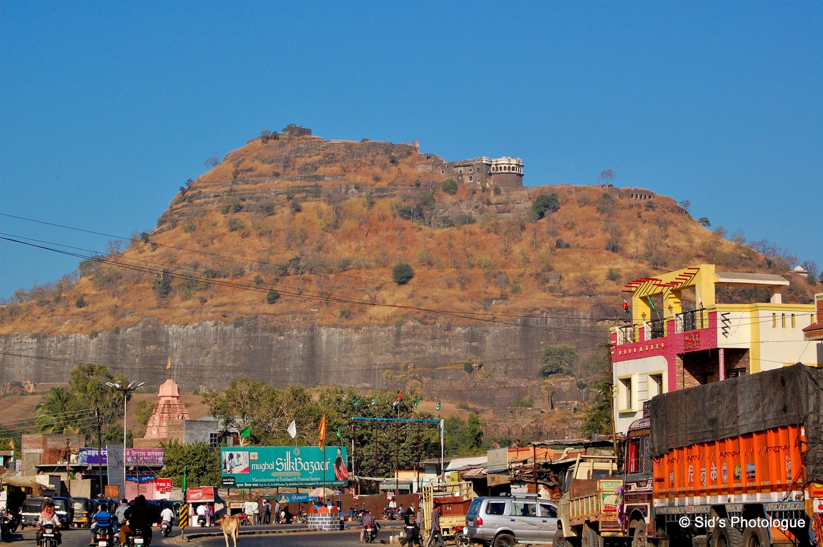
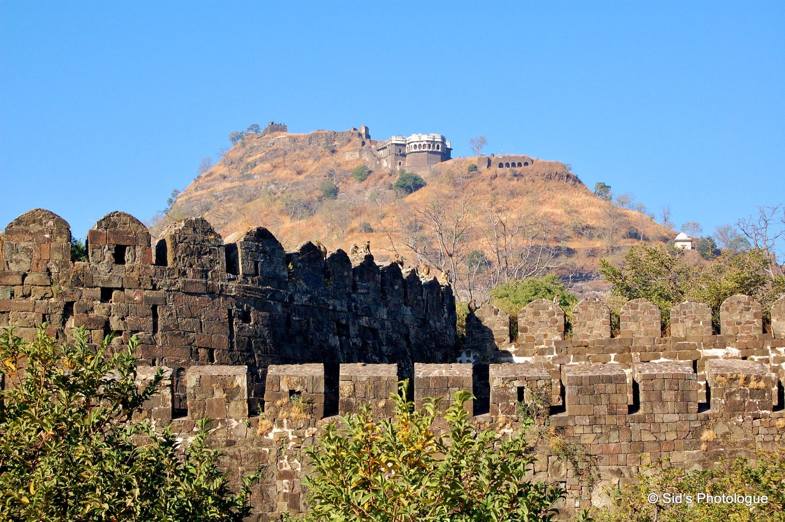
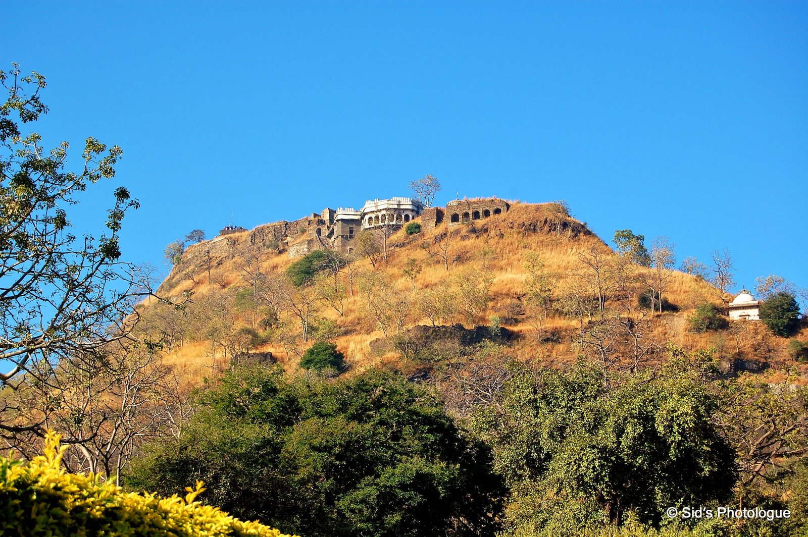
Situated at around 15 km from Aurangabad, enroute to Ellora, is the famous medieval fort of Devagiri. The great pyramidal shape is visible from a good distance as it dominates the landscape.
Mythology suggests that Lord Shiva stayed on the hills surrounding this region. Hence the fort was originally known as Devagiri (Hills of Gods)…..
Devagiri was an important city along caravan routes that connected north to the south of India.
The fort was built by the first Yadav king Raja Bhilamraj in 1187, who renounced his allegiance to the Chalukyas and established the power of the Yadava dynasty in western India.
Once considered invincible, Devagiri yielded to enemy assault and passed into the possession of the Sultans of Delhi in 1308 A.D…
Thirty years later, Devagiri was to attain a brief period of glory as India’s capital. Muhamad Tughluq, ascending the Delhi throne, ordered his capital to be moved from Delhi to this southern city which he renamed as “Daultabad”, the City of Fortune. Tughluq was constantly known to shift the capital from Delhi to Devagiri and Devagiri to Delhi.
However, Daultabad grew to be a great city, rivalling Delhi in size and importance. The province later broke away from the rule of Delhi. By 1499 the Nizam Shahis of Ahmednagar not only captured but also made Daulatabad as their capital in 1607. The subsequent period witnessed a series of wars between the Deccan Sultans and the Mughals under Akbar and Shah Jahan. In 1633 AD the Mughal Governor of the Deccan under Shah Jahan, captured the fortress and imprisoned the Nizam Shahi prince Husain Shah
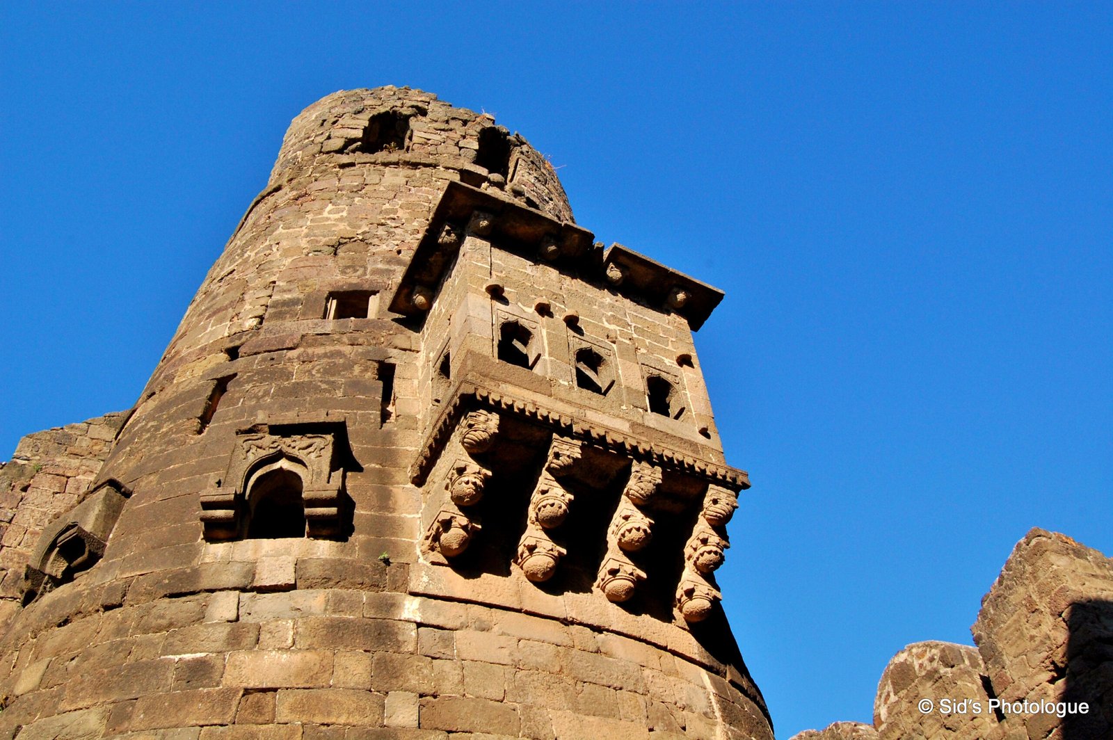
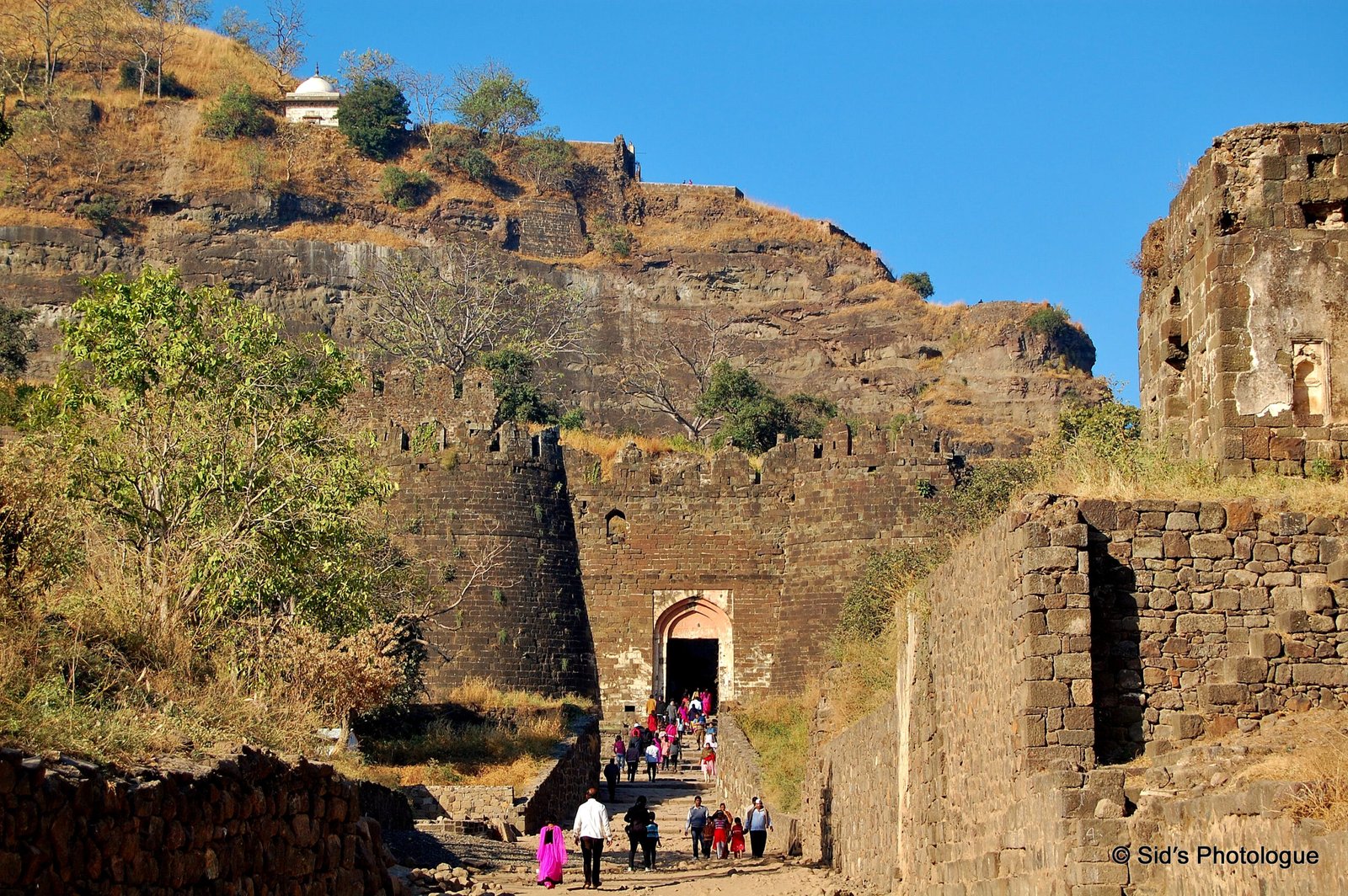
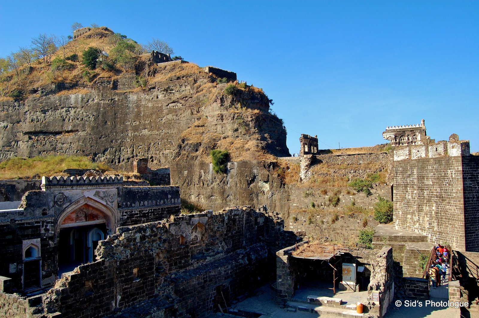
The fort stands on a conical hill, about 200 meters high. Much of the lower slopes of the hill has been cut away by Yadava dynasty rulers to leave 50 meter vertical smooth hill sides, that no hostile troops could scale the heights
Over a period of time, the original fortress was fortified with additional defence mechanisms…..
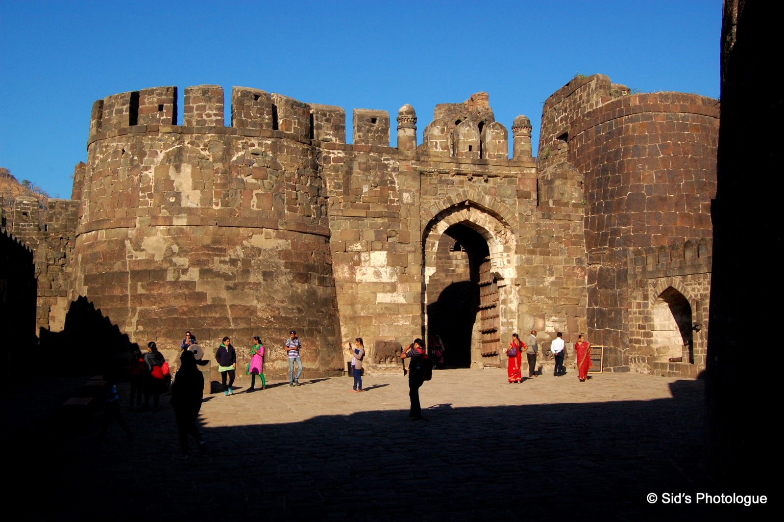
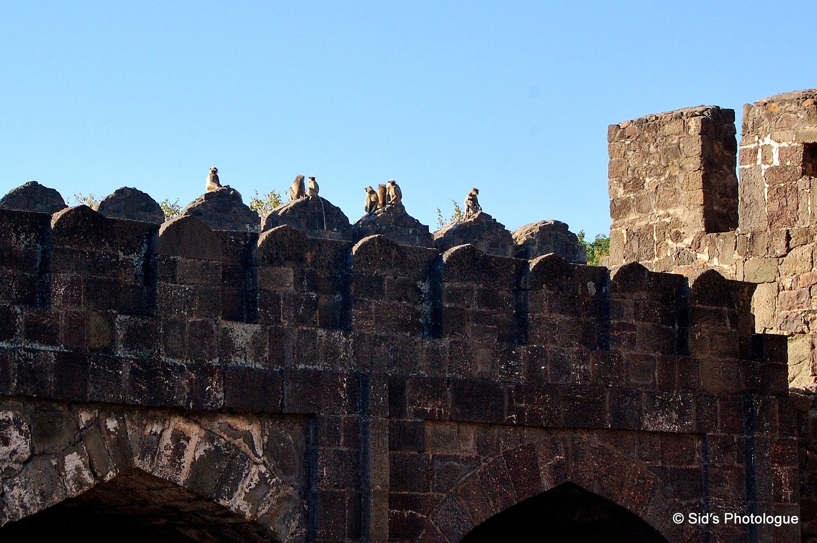
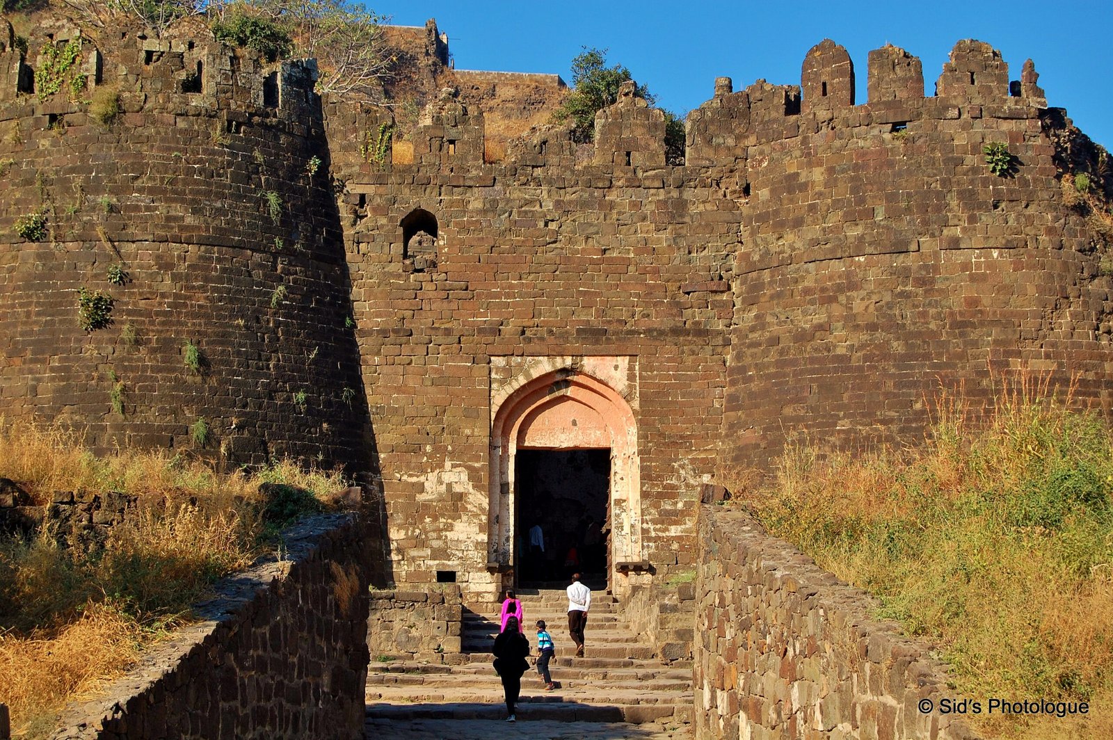
Six rings of fort walls were added to make the fortress practically impregnable.
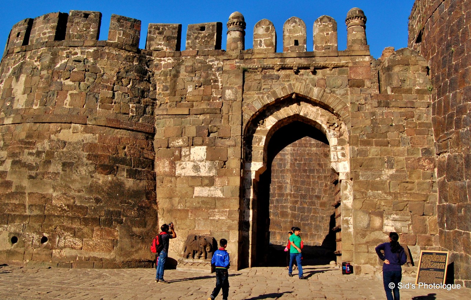
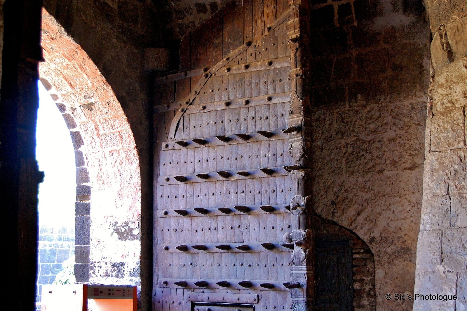
The outer most wall runs for six kilometres and there are several inner walls with heavy iron gates fitted with elephant spikes.These spikes prevented the use of elephants to force open the gates.
The first gateway leads into the enclosure which has, at the left, a huge water tank and further up there is an ancient Hindu temple.
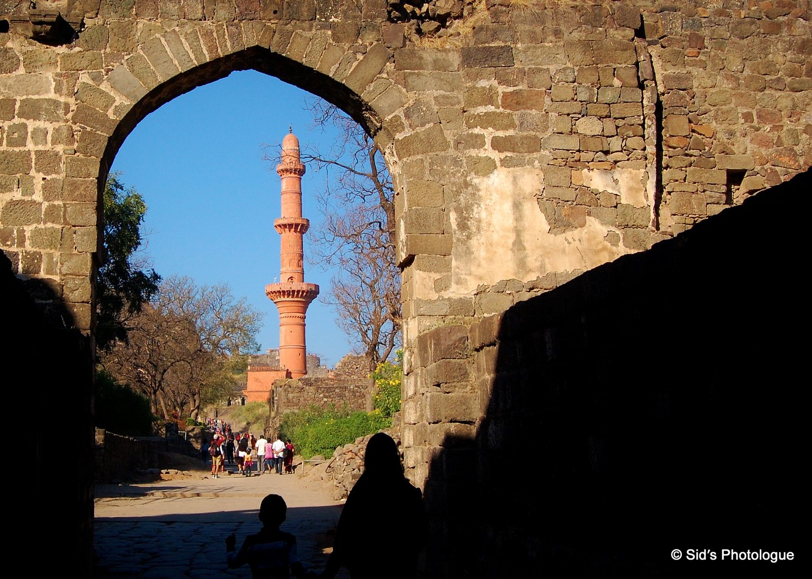
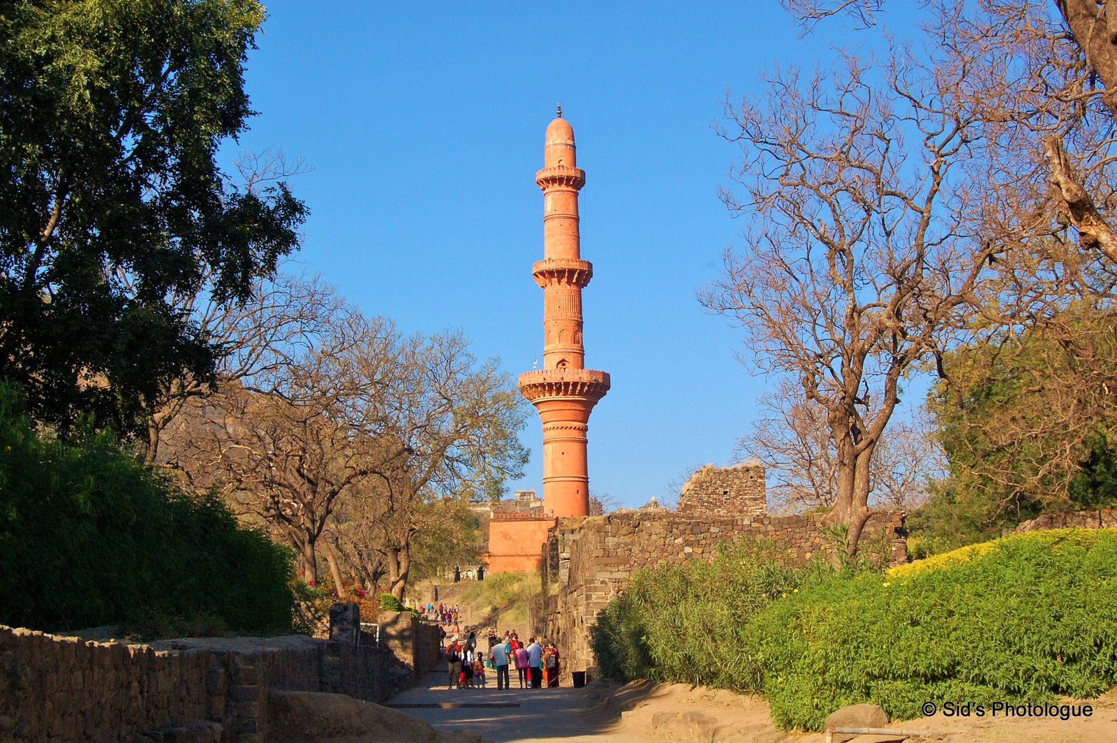
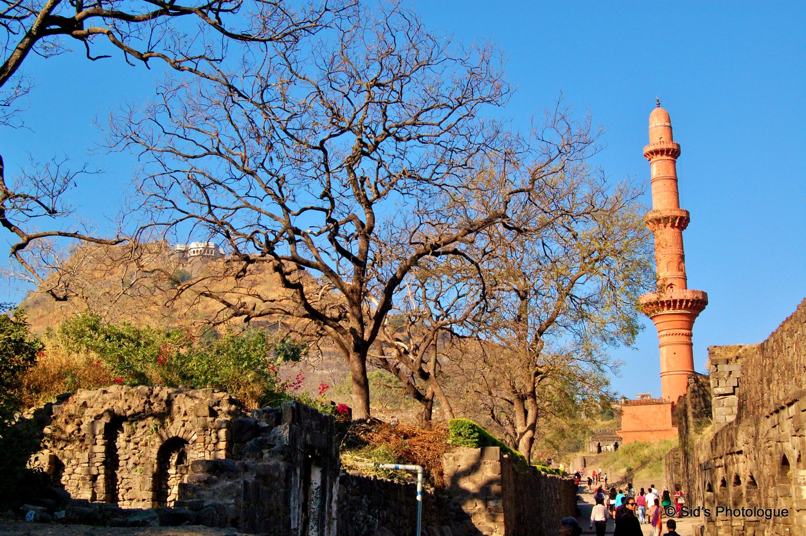
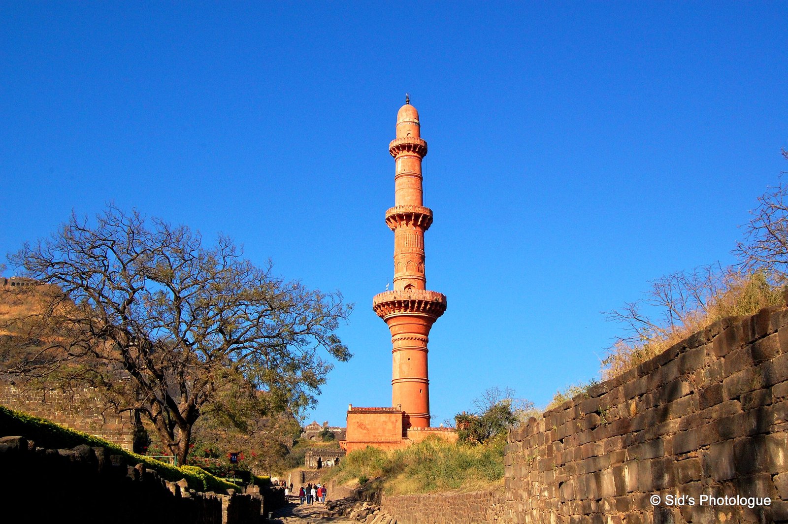
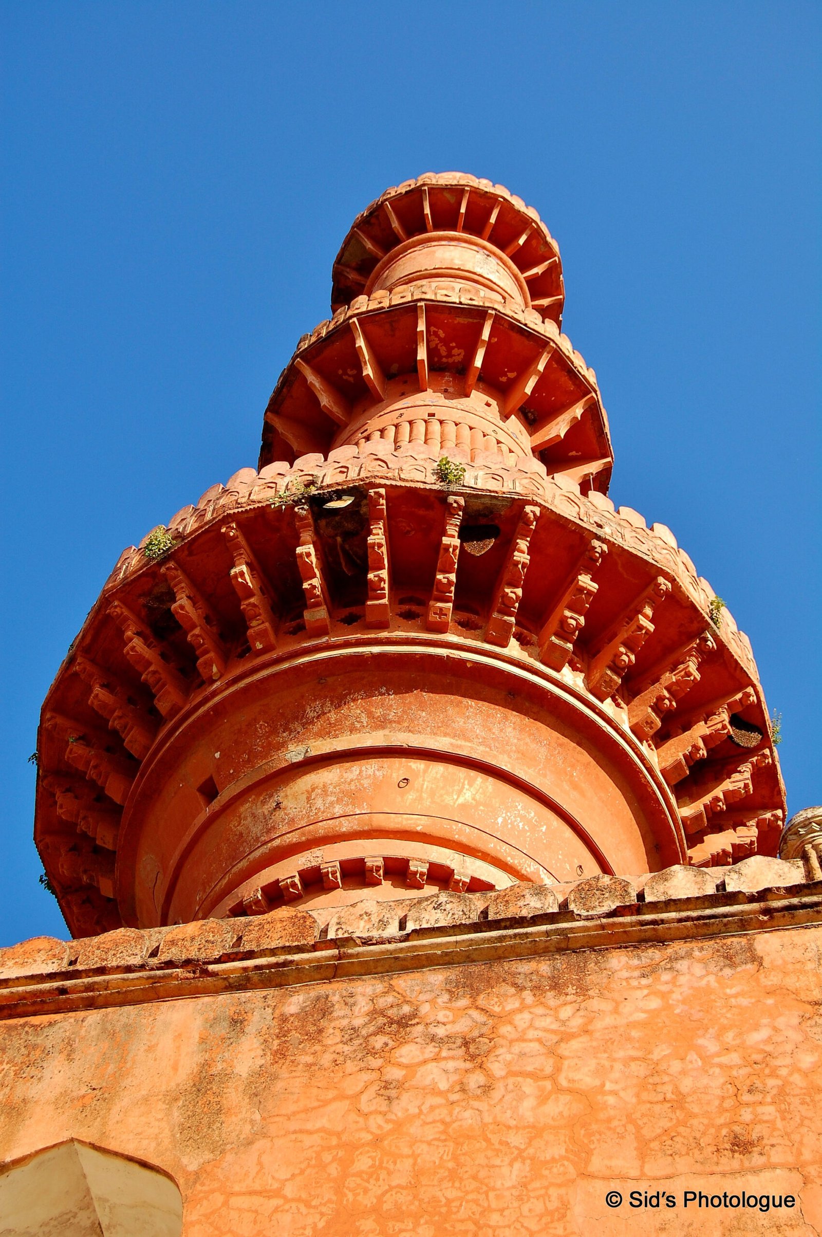
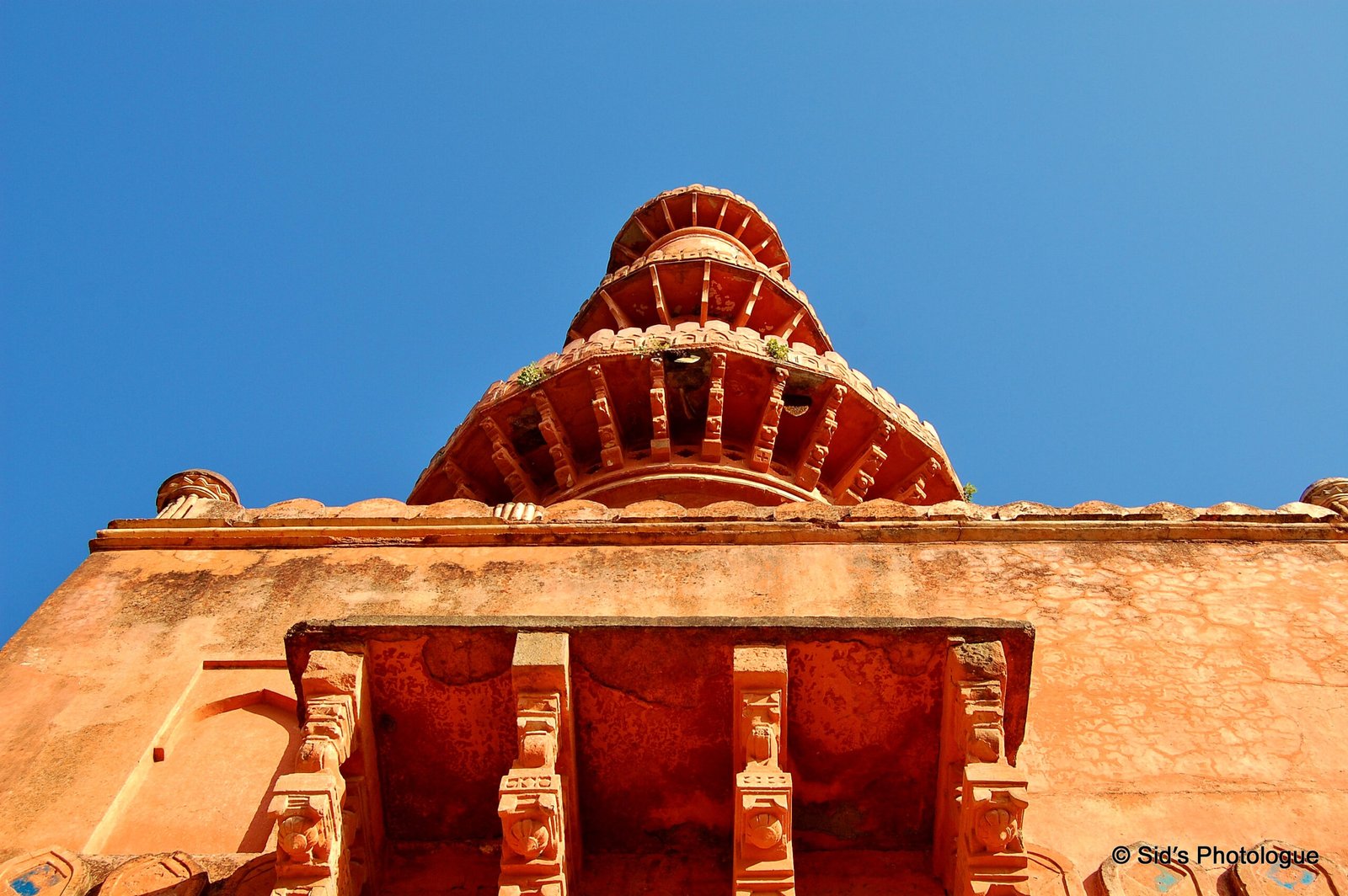
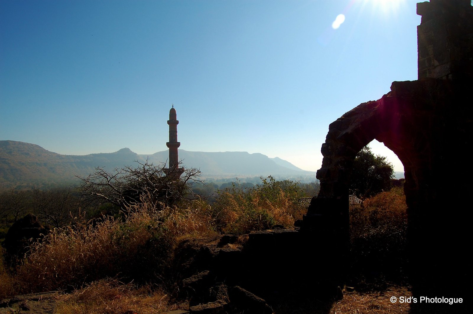
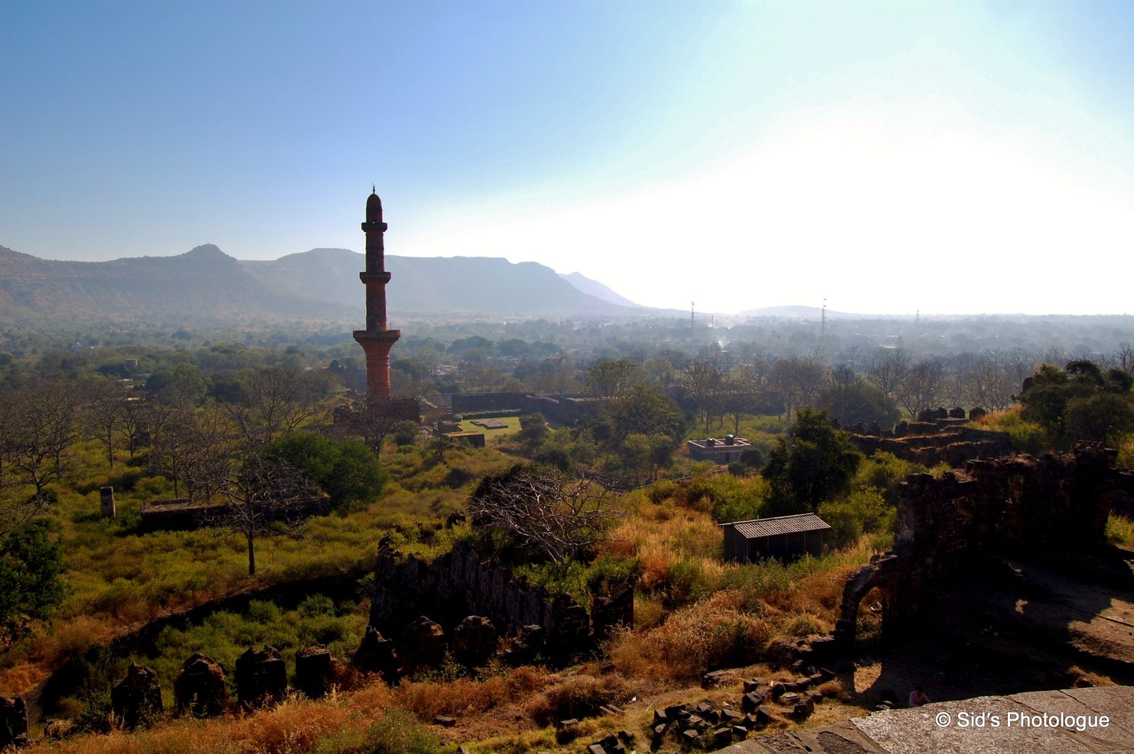
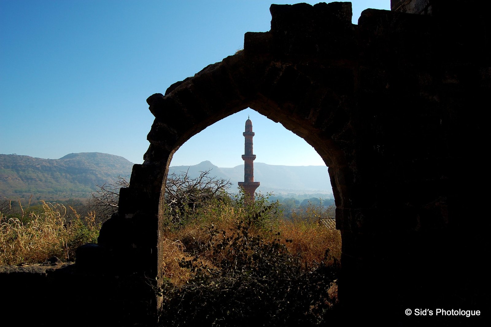
Towards the right is the Chand Minar……
The Chand Minar (or the Tower of the Moon) is a huge tower, which is 210 ft high and 70 ft in circumference at the base……
It was erected in 1445 by Ala-ud-din Bahmani to commemorate his capture of the fort…….
……and was originally covered with beautiful Persian glazed tiles, whose remnants can still be seen!
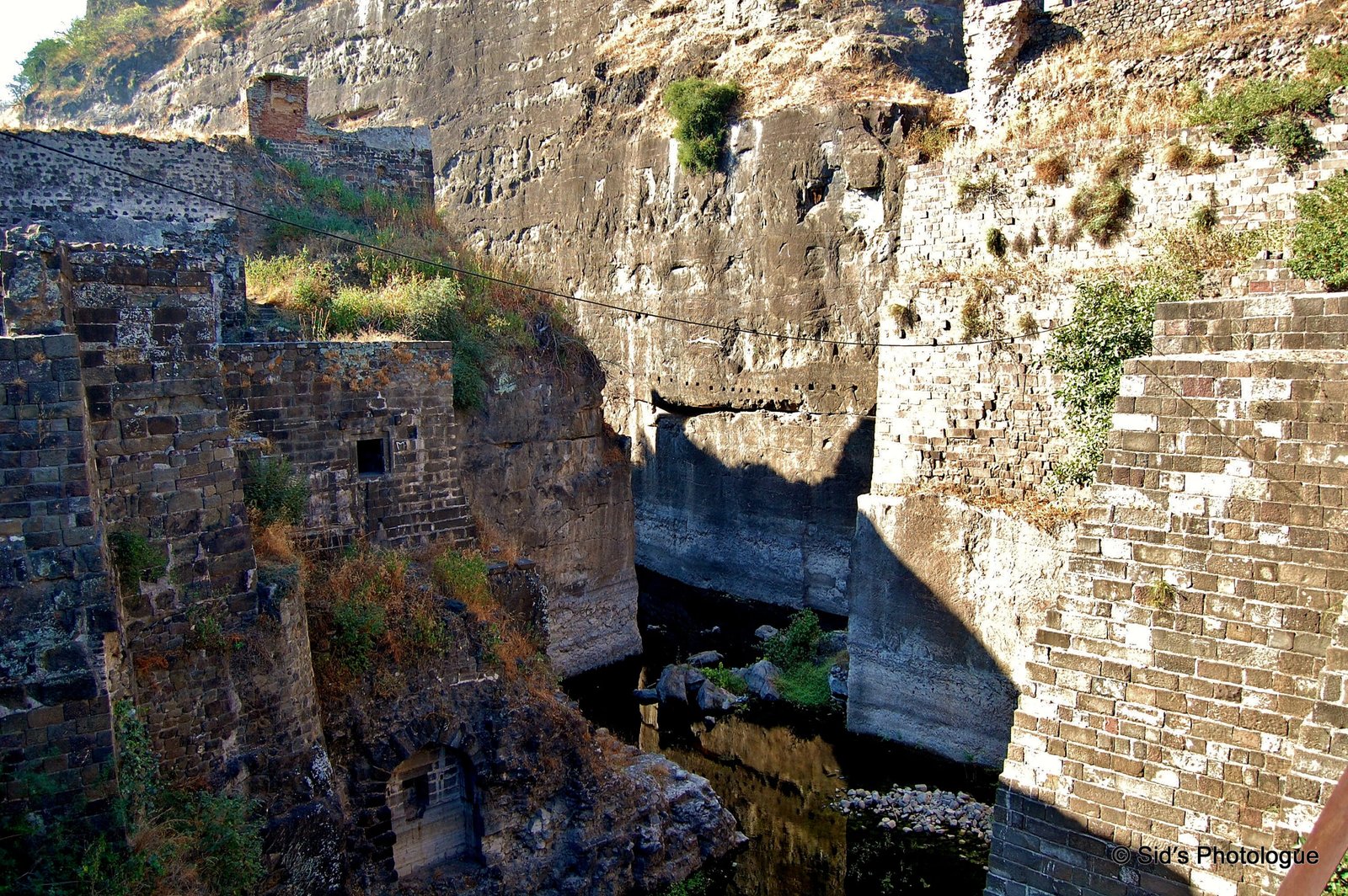
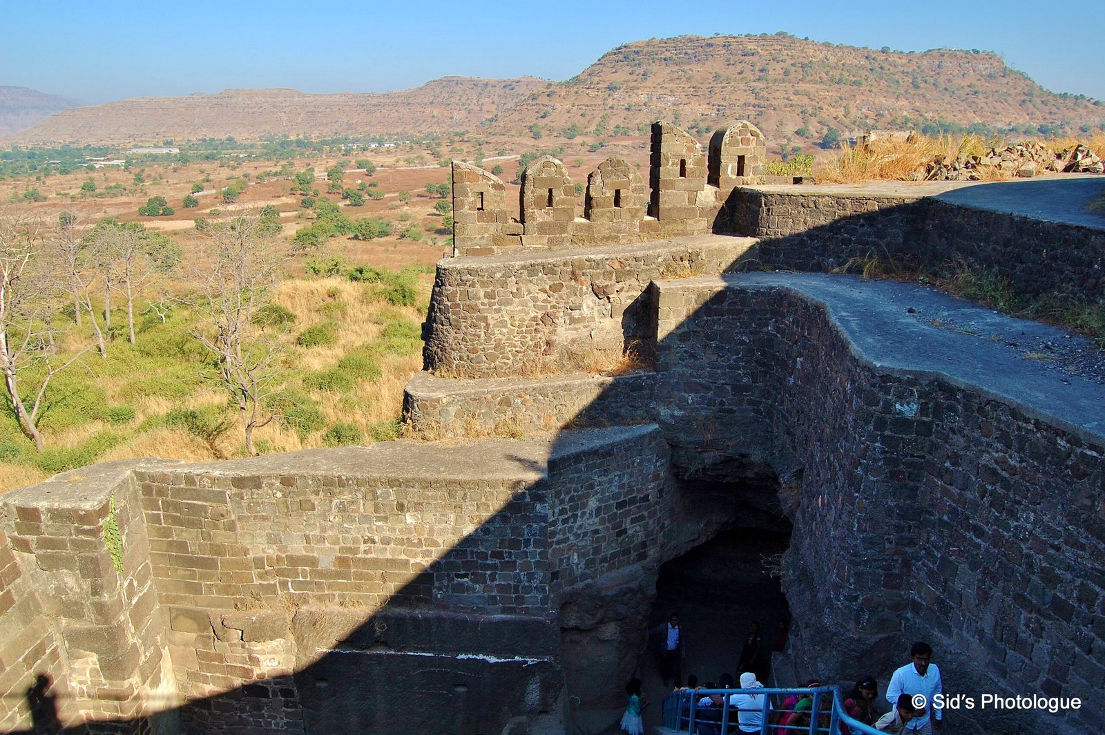
Beyond these fortified wall structure is the moat, twelve meters(40 ft.) deep, with a drawbridge…….
…….here begins the original citadel of Devagiri. The solid rock is scraped to a height of about 76 metres
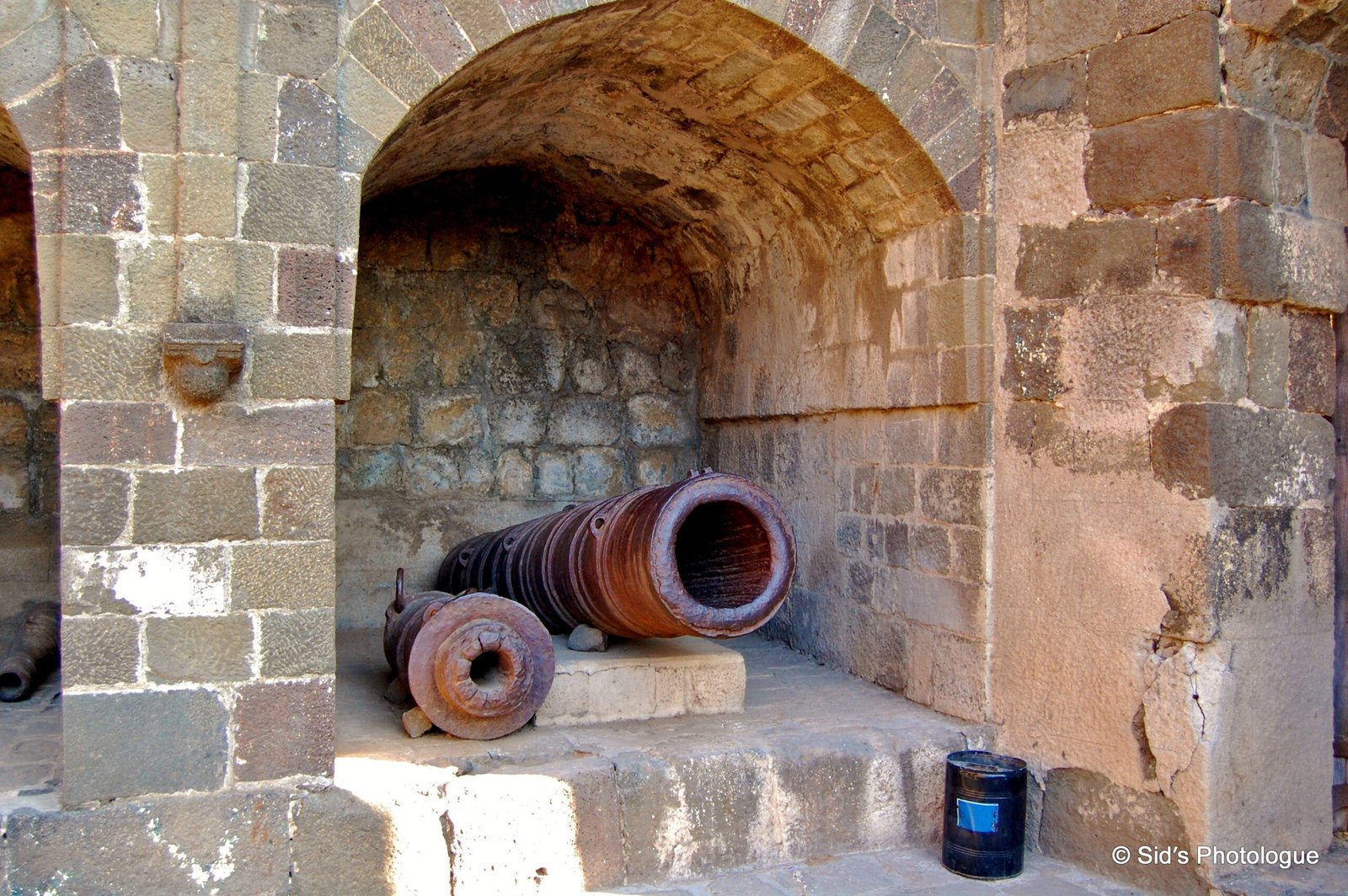
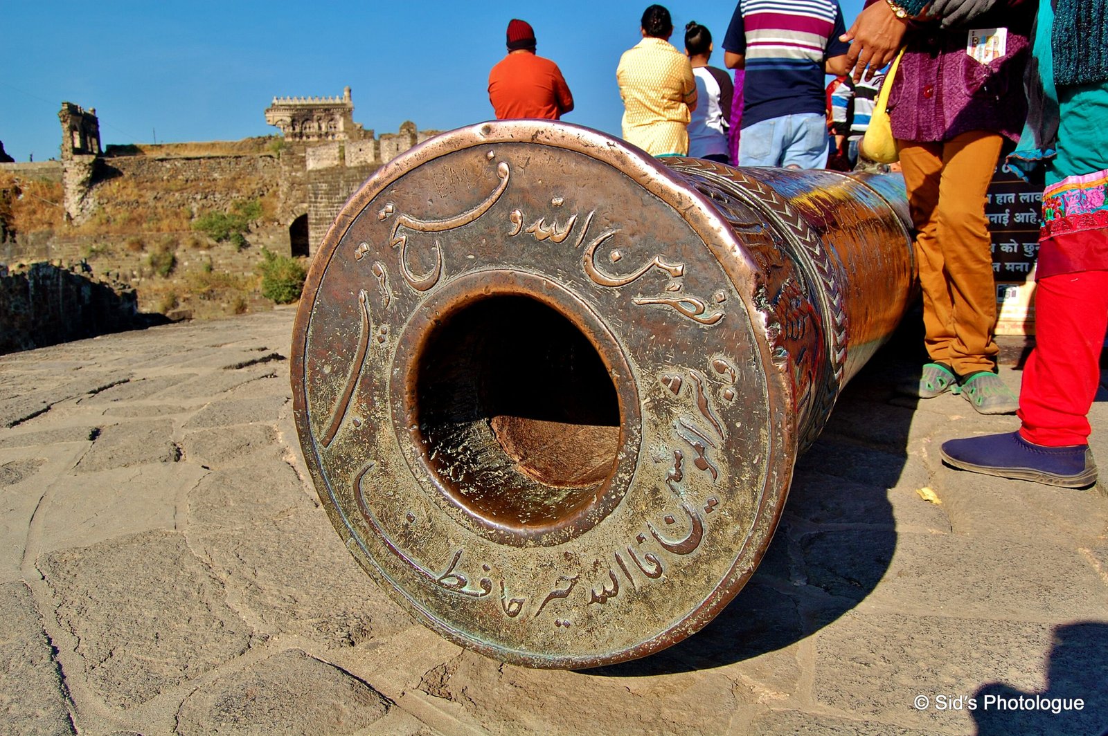
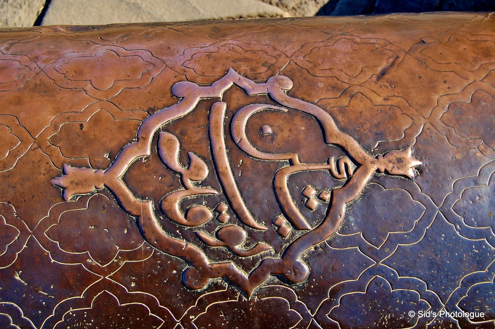
A large number of cannons are found at Daultabad Fort, some in their original places like bastions on fort walls and circular towers while others were collected from various locations and displayed in the courtyard near the entrance gate…..
The cannons displayed near the entrance gate of the fort, represent many varieties of guns. Some are huge, while some are ornate.
Close to the top of the fort, there is a fresh water reservoir, fed apparently by some underground stream. The water management system is unique with a network of terracotta pipe lines, drains etc.
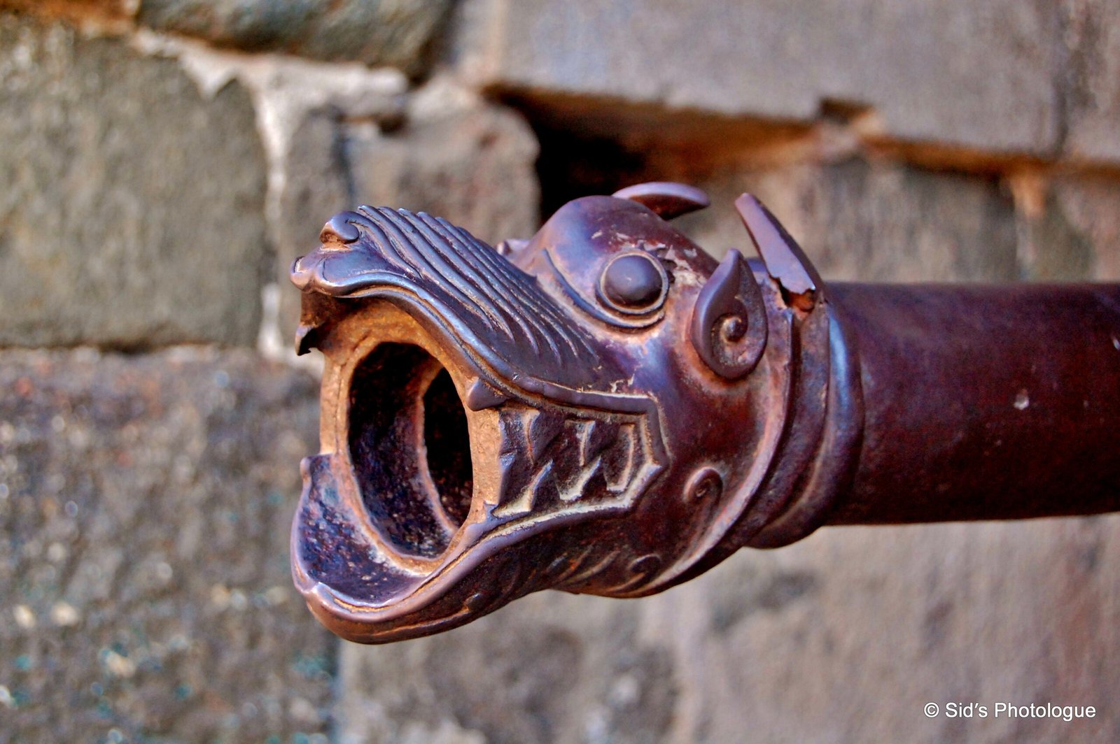
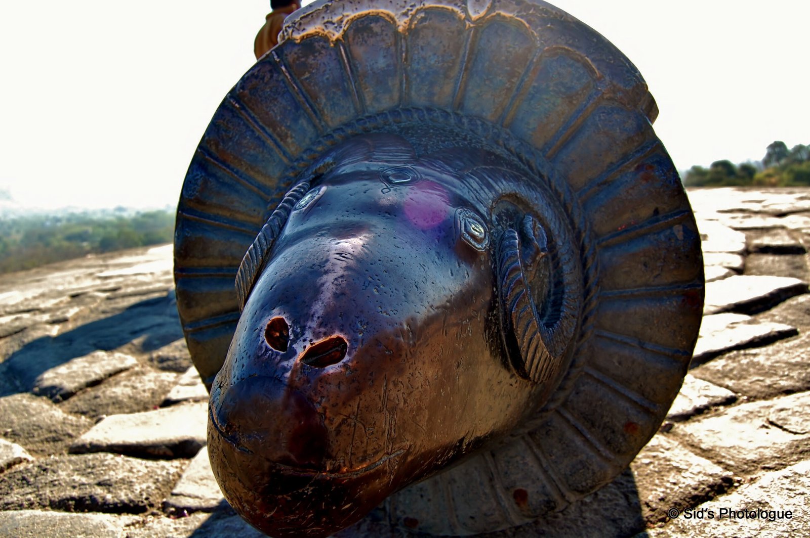
Other noteworthy canons of Daultabad fort include the Mendha tope (Ram Canon) which is the largest piece of artillery in Daultabad fort.
It is about five and a half metre (17 ft.) long, has a name inscribed on it and lies at the top of a round high bastion.
It has ram’s head designed at one end, hence the vernacular name Mendha Tope (Ram Canon)
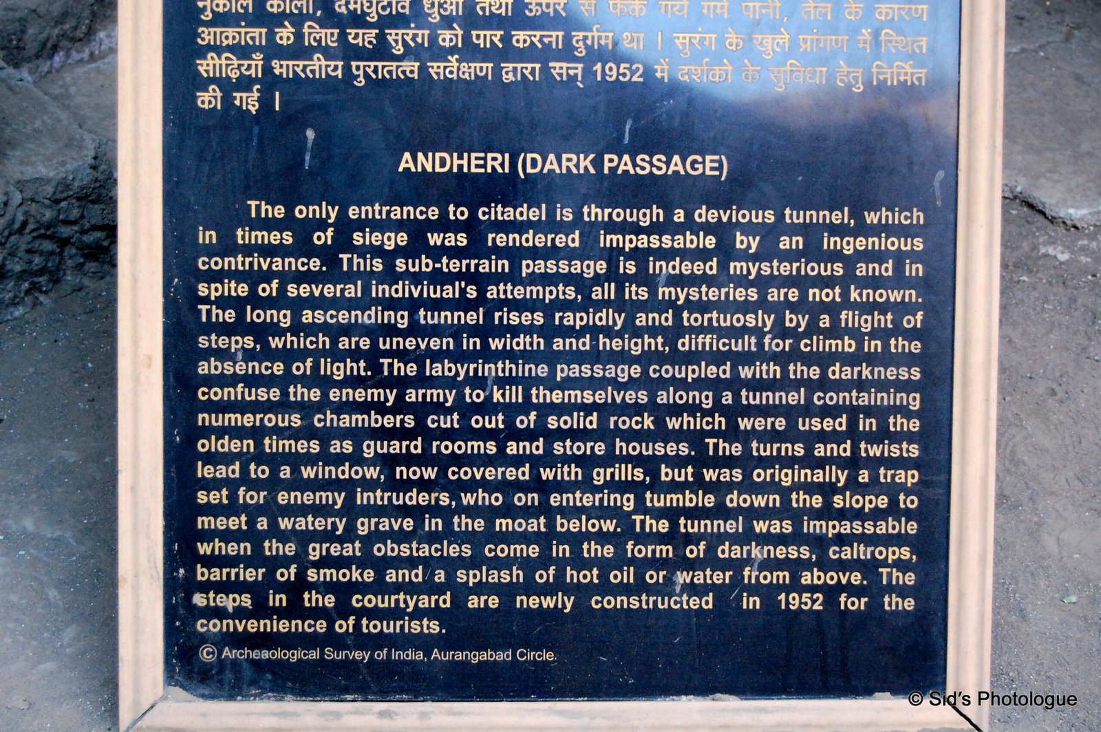
There is only one narrow entrance over the moat. The upward climb leads to a passage, the ‘Andheri’ (the dark passage)…..
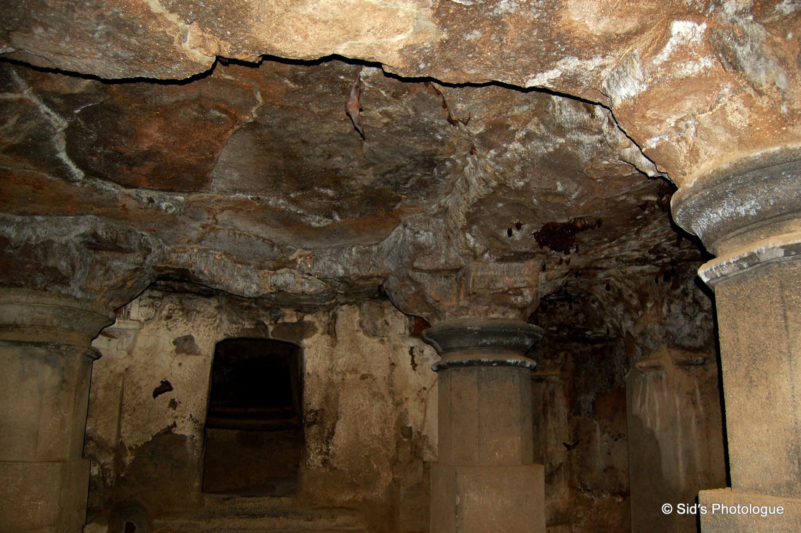
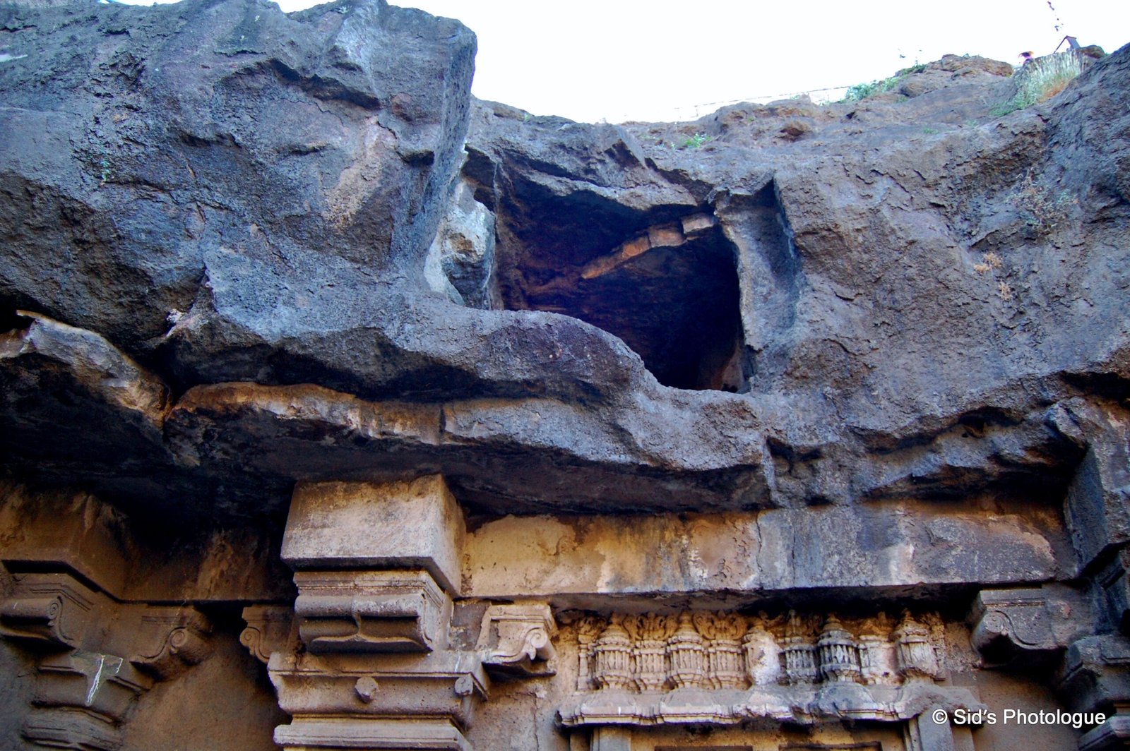
…….It spirals darkly into a long ascending tunnel that rises rapidly & tortuously by a flight of uneven steps. These steps are shielded by the rock mass overhead….
which has the secret stations to either fire at the unprepared enemy or pour hot oil onto them !!!
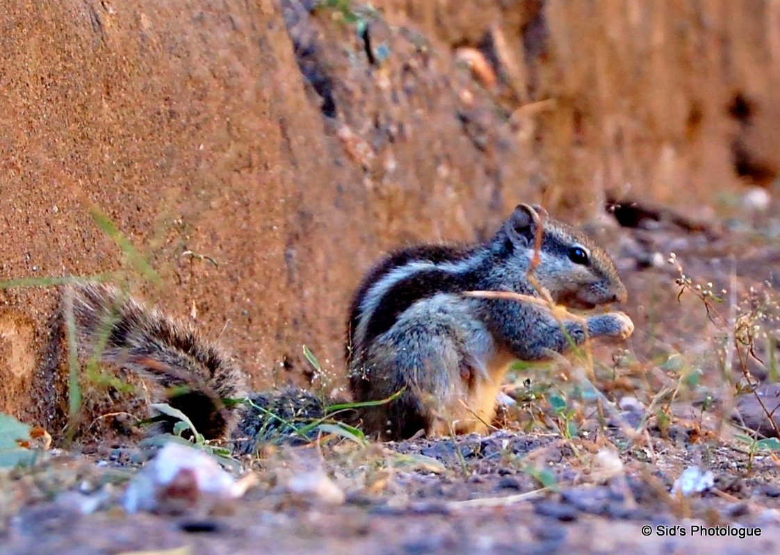
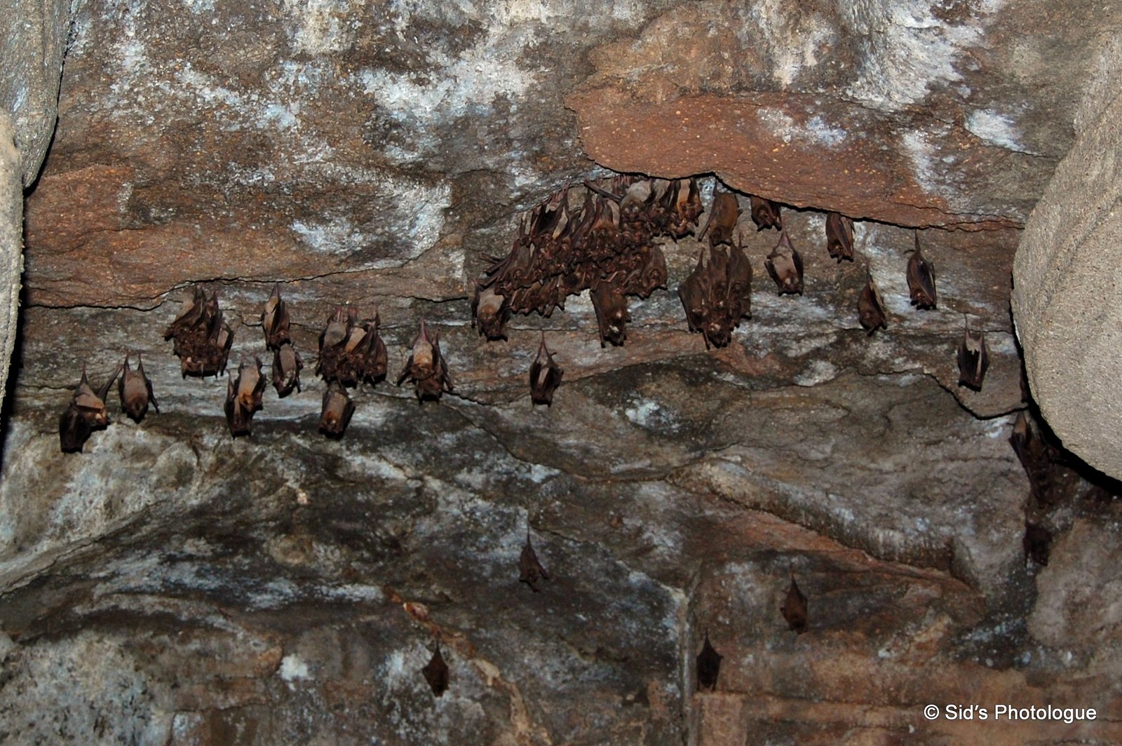
Probably the only creatures who had unrestricted access in & out of the Andheri passage !!
Close to the top of the fort, there is a fresh water reservoir, fed apparently by some underground stream. The water management system is unique with a network of terracotta pipe lines, drains etc.
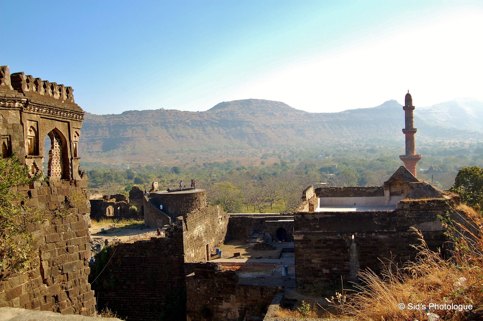
Further up, there is a pavilion and a bastion with a gun. From this spot, there is a wonderful view of the countryside around.
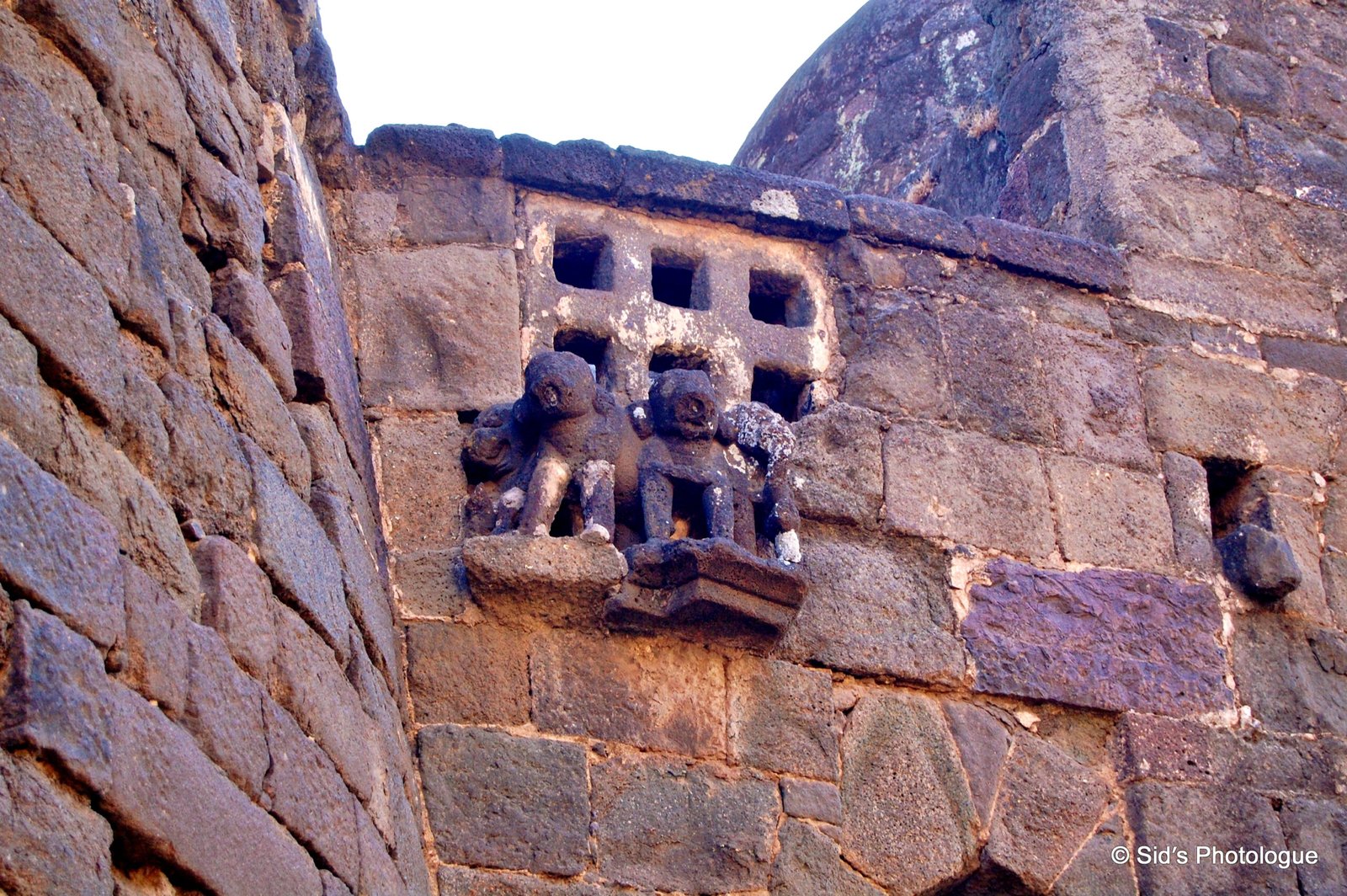
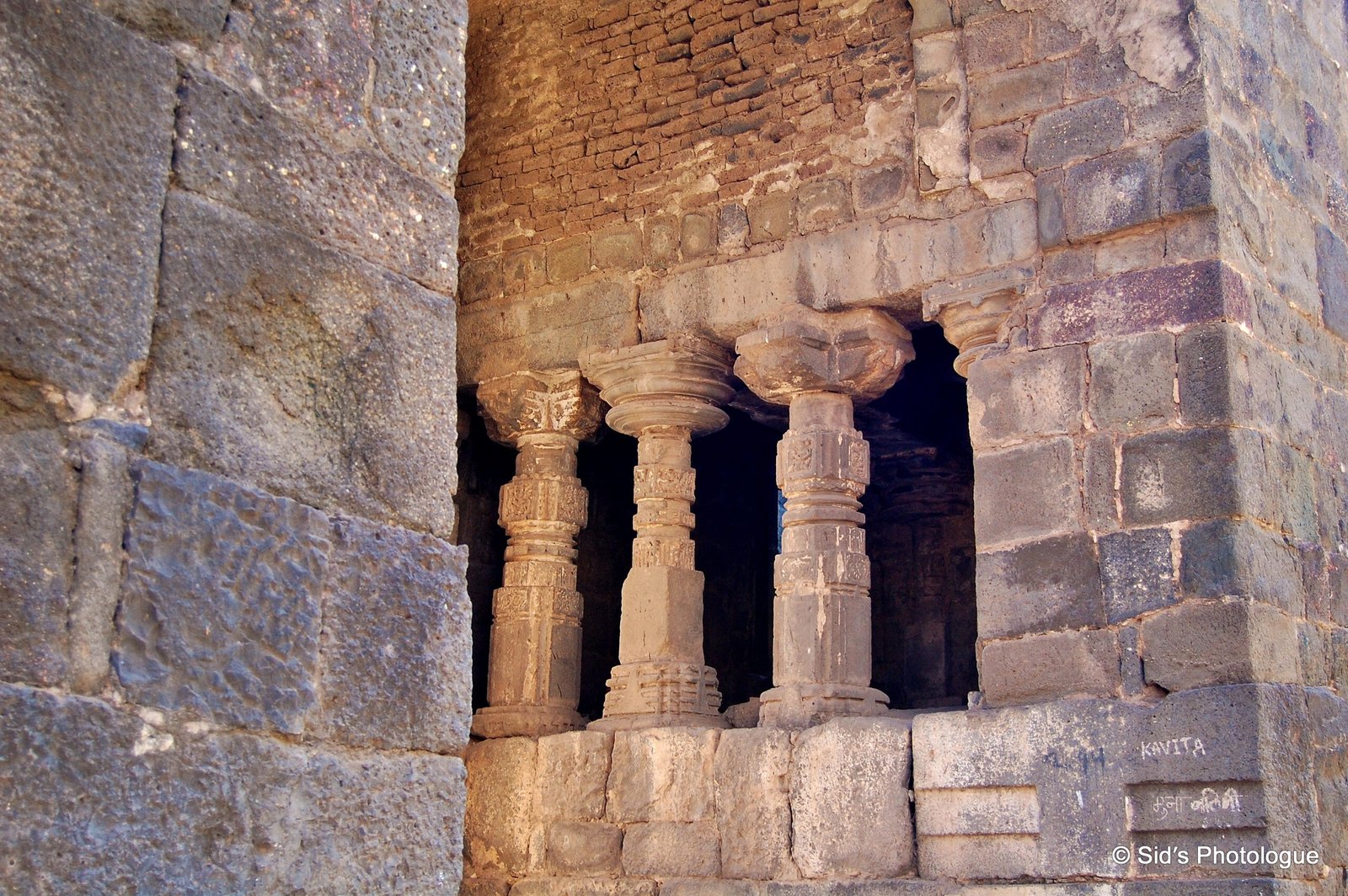
The entire fort complex consists of an area approximately 95 hectares in size. The combination of hill and land part of the fort, is divided into small sectors, demarcated by the fortification walls. The fortified Ambarkot is planned for common people. Mahakot area having four distant lines of enclosure walls served the residential area for higher class of the society. The Kalakot is the royal residential area with double line of fortifications. The Balakot is the pinnacle portion. The fort consists of structures like stepped wells, Reservoirs, Minar, Hammam, Baradari, various Palaces for the Royals, Andhari, Temples, Mosques, and also houses 10 unfinished rock cut caves.
The ruins of the citadel that was once a capitol of India, is indeed a medieval wonder and an archaeological marvel of military engineering, amazing town planning with unique water management system and architectural excellence with a confluence of strong political and religious belief.